
By Toni Smith
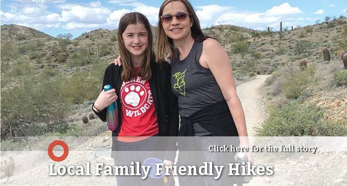
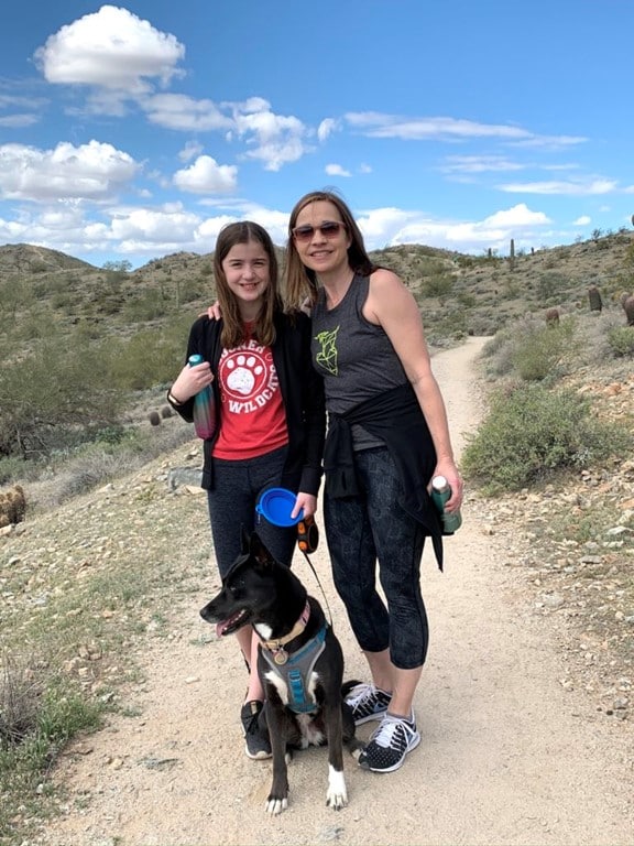
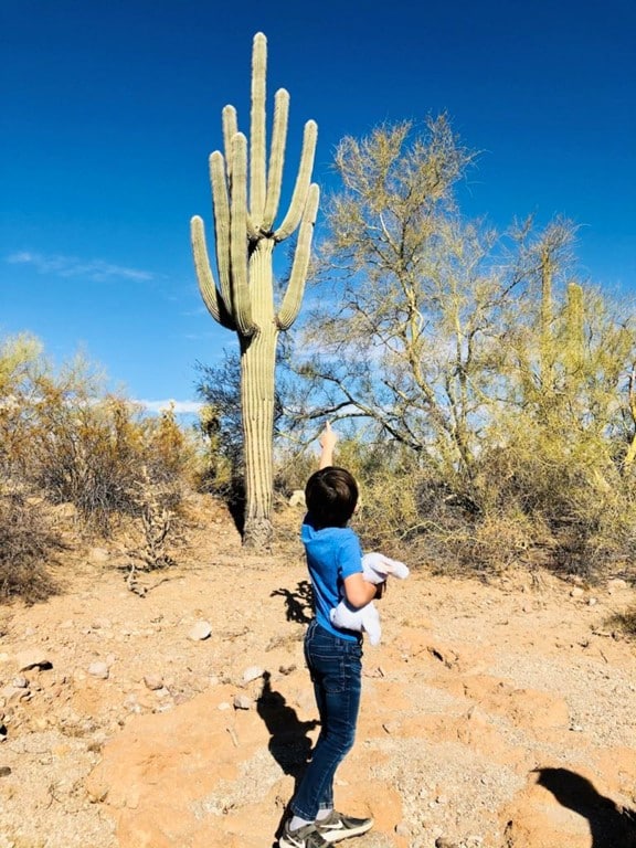
Sometimes I forget what a beautiful place Arizona is, but I always remember when I go hiking. For example, no matter how many times you see a saguaro, you can’t deny that they look absolutely majestic. But if you’re a kid, a saguaro is the perfect spot to take a photo of you holding up your arms like a cactus. Seeing quail cross your path is always something that brings a smile and seeing a jackrabbit or lizard are just as cool.
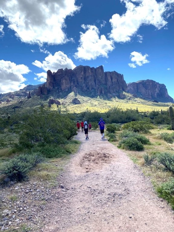
Spring and fall are excellent times to bring your kids in tow and go for a family friendly hike in Tempe or nearby Phoenix. As a bonus, I bet you and your kids will have so much fun that you will forget that you are getting exercise. There are so many family friendly hiking trails in the Tempe area. To help you narrow down your options, we have written this guide of trails that we think are a great fit for toddlers to teens.
When you go out on a hike with the whole family, remember a few simple tips:
- Always bring lots of water for everyone and a good rule of thumb is to turn around when you have half of your water supply left.
- Stay on the designated trails.
- Bring snacks for your kids (and for you too). Hiking isn’t fun when you or your companions get hangry.
- If you do bring snacks, remember to pick up your trash and #leavenotrace.
- And a few words about sunscreen. Apply sunscreen liberally and often. The famous Arizona sunshine feels so warm on your skin, but you don’t want a sunburn to be a souvenir from your hiking excursion.
“A” Mountain
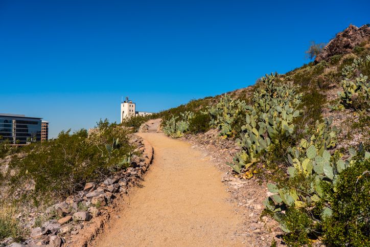
If your kids have lots of energy, “A” Mountain is a good hike to start their hiking adventures. You will begin the trail off of Third Street and Mill Avenue in Downtown Tempe, near the light rail tracks. Look for the brown sign that marks the trailhead. Follow the trail to your right and you will find yourself on a couple of switchbacks that crisscross the front of the mountain. At the end of the first switchback trail, look up to see the large black rock formation a few feet north of where you are standing. If you look closely, you will be able to see petroglyphs created by ancient people almost a thousand years ago. I always like to combine hiking with a little bit of Arizona’s heritage. Just do not go off the trail to get a closer look – that is prohibited.
Once you go up the wooden stairs, you will be at the steepest part of the trail, the paved path to the top. The paved path leads to the first summit of the trail, just at the bottom of the “A”. You can hang out near the overlook at take some amazing photos of the cityscape. And, if you have a little gas left in the tank, you can continue to the very top of the trail. Just look for the path with stairs and a handrail to the right of the “A”. If you are hiking at a steady pace, this hike takes around 30 minutes, plus or minus time if you take extra time to enjoy the view from the top.
tempe.gov/amountain
Hole in the Rock at Papago Park
Located just minutes north of Tempe, Papago Park is one of the most scenic and easily accessible desert areas in the Phoenix metro area. Explore its 1,500 acres filled with hiking and biking trails, picnic areas and lagoons. Papago Park is also home to attractions including the Hole in the Rock hike, Desert Botanical Garden, the Phoenix Zoo and AZ Heritage Center. Three of the most scenic trails are located in the Phoenix side of the park:
Double Butte Loop and Elliot Ramada Loop: Park in the West Park parking Lot, located on Galvin Parkway across from the Phoenix Zoo entrance. From the parking lot, follow the Double Butte Loop trail to access both buttes on this side of Papago Park. There are picnic tables between both buttes if you would like to stop for snacks. From the same parking lot, you can get to the Elliot Ramada Loop that is a dirt and paved path, so it is accessible for wheelchair users.
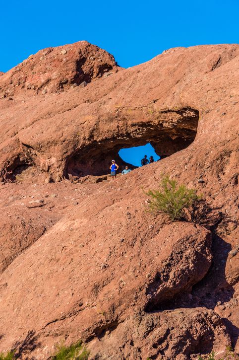
Hole in the Rock: Enter the Phoenix Zoo parking lot and veer to the left. There will be gates to pass through to enter the Hole in the Rock parking lot. Follow the road to the right to a parking lot and ramada. The trail is accessed behind the mountain. It is a well trafficked trail that is busiest at sunset. The hike to the “hole” will only take about 10 minutes and offers a beautiful view of the city and the desert below. There is also a lagoon between Hole and the Rock and the Zoo that is a nice photo spot.
Hunt’s Tomb: Park either near Hole in the Rock or on the north side of the Phoenix Zoo parking lot. Follow the paved road around the lagoon and you will find the trail to Hunt’s Tomb. It is one of the metro area’s most unique landmarks. The white pyramid shaped tomb is the final resting place for George W.P. Hunt, Arizona’s first governor, his wife, their daughter, and his wife’s family. Why a pyramid you ask? The rumor is that Governor Hunt had a fascination with Egypt. This is short and sweet hike, so it’s perfect to combine with another hike in Papago Park.
For maps and more information please visit: phoenix.gov/parks/trails/locations
South Mountain Preserve
South Mountain Park & Preserve
South Mountain is an easily accessible desert preserve in the metro area, located in Phoenix just south of Tempe. It is also one of the largest municipal parks in the country at more than 16,000 acres. I learned that it consists of three mountain ranges: Ma Ha Tauk, Gila and Guadalupe. There are more than 50 miles of trails here, with several parking areas.
I always go to the Pima Canyon Trailhead, which is located off of Guadalupe Rd. and 48th Street. There’s a South Mountain trail map online that shows you where all of the trails traverse the park, and the City of Phoenix provides a description of each trail on their website. Here are a few trails in the Pima Canyon area that we think are great for kids.
Marcos de Niza Trail: Park along the access road at the Pima Canyon Trailhead or if you’re lucky, grab a spot in the parking lot at the end of the drive. The Marcos de Niza trail entrance is to the left of the parking lot. It is not a gradual elevation – you will head straight up the mountain as soon as you start. It will take about 10-20 minutes to get to the summit, depending on your speed. You can go up and come straight down or continue along the ridge for as long as you would like. Fun Fact: about 1/3 of the way up this trail, you will see a metal cage around an inscription on the rock. It looks like it was carved by Marcos de Niza, the Spanish explorer. Our local NPR station did some investigative work to determine its authenticity. It is a good story (kjzz.org/content/20496/did-you-know-marcos-de-niza-inscription-south-mountain-not-real). This hike is better for kids 6 and up, depending on their hiking abilities.
National Trail: If you have younger kids who are more runners than hikers, this is a great trail. With the parking lot and bathroom facilities on your left and a ramada on your right, keep walking straight and pass through the yellow pylons to access this trail. It is a scenic path that is just a slight elevation change, and it connects to other trails along the way. Because this trail is relatively flat and wide, with plenty of space for other hikers and bikers to pass, it’s good for kids as young as three years old. Just be sure to watch your little ones to make sure they do not get too close to a cactus or lift up a rock where a scorpion might hide.
Pima Wash to Santa Cruz Hill: The directions for this trail might seem a little complex, but really, you’re just going to head for the mountains that will reveal the city skyline from the top. From the main road, veer right onto the Pima Wash Trail before you reach the ramada and parking lot area. The trail will go down first (past a wash, hence the name), and then climb up again. When you are at the top of the first hill, look for the brown trail marker for the East West loop and veer to the left. At the bottom of the hill, go right to head east on the Beacon Hill Trail. Then, take the trail marked for Santa Cruz Hill. Follow the Sant Cruz Hill trail upwards and you will be rewarded with really pretty views of Phoenix and Tempe. You can go back the way you came or turn back south on the Beverly/Pima Connector trail. You can see the parking area from here so use that as your guide. Follow the Beverly/Pima Connector all the way back to the parking area. This trip took about 35 minutes and was 1.3 miles long. This is probably best for kids 5 and up.
For maps and more information please visit: phoenix.gov/parks/trails/locations
Usery Mountain Regional Park
3939 N. Usery Pass Rd., Mesa
Usery Mountain Regional Park is 3600-acre park located in nearby Mesa. Usery has nearly 30-miles of multi-use trails ranging from easy to moderate, ideal for walking, hiking, biking, and horseback riding. Another big perk is that the trails are mostly flat for long spans (ideal for biking) and a mix of wide and narrow so families love it because you can release your littles into the desert and easily keep an eye on them.
Crismon Wash Trailhead: An easy place to park is in the dirt lot off Crismon and McKellips Roads. We recommend taking the following route: Take Levee Trail east to Noso Trail and head north until you hit a parking lot and Blevins Trail. Head west of Blevins Trail until you meet Crismon Wash trail and head south until you have returned to the Levee Trail at the trailhead. This route can be adjusted at any point to shorten or add length. In total, this route is mostly flat and is 3 miles total. This is a great trail for little ones as young as 3 or 4 depending on their abilities.
PRO TIP: Use caution when it rains in the area. The wash trails are subject to flooding and should not be entered when flooded.
Wind Cave Trail: If you are looking for something a little more challenging, you might check out Wind Cave trail. It is a little over 3 miles round trip and contains many switchbacks to ascend 2,000 feet to the top where you are met with an open-faced cave with scenic views of the Valley and other nearby mountain ranges, including Tonto National Forest. This hike would be great for kids over 6, as littles might get worn out early on this one.
To access the Wind Cave Trailhead, you will enter the park off Ellsworth Rd, north of McKellips Rd. There is a $7 per vehicle entry fee. Follow the signs to Wind Cave Trailhead on your left-hand side about one mile past the ranger station.
Lost Dutchman State Park
azstateparks.com/lost-dutchman/
This destination is a bit of a drive from Tempe (about 40 minutes), but you will be rewarded with beautiful Sonoran Desert scenery. There are lots of trails at Lost Dutchman State Park, from easy, accessible trails to climbs for the most experienced hikers. There is a park entry fee, $7 per vehicle during the week and $10 per vehicle Fri.-Sun. and on holidays).
Since this is a state park, don’t forget that kids 6-12 years old can become a Junior Ranger. You can download an activity before you visit the park or ask a ranger for a Junior Ranger booklet that you can complete during your visit. Here are a few recommendations for families:
The Native Plant Trail: This is an accessible trail that is also perfect for younger kids. To find it, park in the lot to the right of the ranger station and look for the trailhead just past the accessible parking sign. You will walk alongside a collection of labeled desert plants so you can learn as you go. Ask for a plant guide at the ranger station so you can follow along. Be on the lookout for the “Watch me grow” Saguaro cactus. Its growth has been measured over the past 25 years and you can see that these iconic cacti take a real commitment to grow to their full potential!
Treasure Loop Trail: Rated moderate, this trail is a 2.4 mile loop that conveniently ends at a picnic area. There is a 500 feet elevation change here so be prepared for a steady uphill climb.
Disclosure: This article originally appeared on the Tempe Tourism blog and has been published here with permission.
About Toni Smith: An Arizona native, Toni loves to dine out, conquer hiking trails, go to concerts, and survive hot yoga classes. She has also never met a dog she didn’t love instantly. She lives in Tempe with her husband and daughter.